Vitrine de sciences du CGQ : roche, papier, géo... 2.0

La grande vitrine de la bibliothèque s'anime à nouveau.
Tout d'abord une grande bannière et un diaporama viennent célébrer les 175 ans de la Commission géologique du Canada (1842-2017). D'autres activités pour souligner cet âge vénérable aurons certainement lieu plus tard cette année.
Ensuite deux publications scientifiques récentes sont mises en évidence pour souligner le partenariat du Centre géoscientifique de Québec (CGQ), qui est le nom officiel du partenariat entre la CGC et le Centre Eau Terre Environnement de l'INRS.
--
- Gosselin JS, Rivard C, Martel R & Lefebvre R (2016) Application limits of the interpretation of near-surface temperature time series to assess groundwater recharge. Journal of Hydrology 538:96-108. Doi: 10.1016/j.jhydrol.2016.03.055
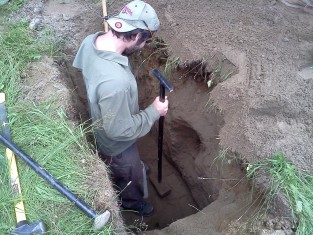
Dans la vitrine, on voit une sonde TDR pour mesurer la température du sol similaire à celles utilisées lors des travaux de Jean-Sébastien.
Le principal objectif de cette étude était de tester les limites d’applicabilité d’une méthode d’évaluation de la recharge basée sur l’utilisation de séries temporelles de températures prélevées à différentes profondeurs dans la zone non saturée du sol et ce, pour différents climats, représentatifs de diverses régions au Canada. Ceci a été fait en utilisant un modèle numérique vertical du transport simultané de chaleur et de l’eau dans le sol. Les résultats ont montré que, dans des conditions idéales, il serait possible d’évaluer la recharge annuelle lorsque celle-ci est supérieure à 200 mm/an, avec une incertitude très acceptable de moins de 20%. Cependant, l’erreur devient rapidement beaucoup trop grande lorsque les erreurs de mesure sur les températures et l’incertitude sur les paramètres du modèle numérique sont considérées. Il s’avère donc que les techniques basées sur la chaleur ne sont pas bien adaptées à l’estimation de la recharge diffuse pour des conditions réelles. Elles peuvent néanmoins représenter une approche intéressante pour des applications utilisant des matériaux synthétiques aux propriétés connues ou dans des conditions très contrôlées tels que des essais en laboratoire.
The main objective of this study was to test the application limits of a groundwater recharge assessment technique based on subsurface temperature time series collected at different depths in the unsaturated zone for various climates representatives of different regions in Canada. This was done with numerical modeling using a vertical one-dimensional coupled heat and moisture transport simulator. Results show that, under ideal conditions, it would be possible to estimate annual recharge rates when the latter is above 200mm/y, with an acceptable error of less than 20%. However, the error increases rapidly beyond the recharge value itself when measurement errors of soil temperatures and model parameter uncertainty are taken into account. This indicates that heat-based techniques for the assessment of diffuse groundwater recharge rates are likely not well suited for real field conditions. They could, nonetheless, represent an interesting approach for applications carried out in engineered materials and under controlled conditions such as in laboratories.
--
- Tremblay A & Pinet N (2016) Late Neoproterozoic to Permian tectonic evolution of the Quebec Appalachians, Canada. Earth-Science Reviews 160:131-170. Doi: 10.1016/j.earscirev.2016.06.015
Cet article présente la première synthèse des connaissances sur le segment québécois des Appalaches depuis celle de St-Julien et Hubbert (1975), il y a déjà 40 ans.
Due to the unique location of the Quebec Appalachians in a re-entrant of the paleo-North American margin and to the fact that the area largely escaped late Paleozoic deformation, this segment of the orogen preserves evidence of the early orogenic stages that are partly obscured elsewhere. Despite diachronicity both along- and across-strike of the orogen, five tectonic events of regional significance are recognized: (1) the earliest event is mainly recorded by Neoproterozoic to Early Ordovician normal faults associated with extension of the Laurentian craton and the establishment of a passive continental margin; (2) the second event, (the Ordovician Taconian orogeny), is marked by foreland-directed deformation and corresponds to the principal deformational and metamorphic events recorded by the Laurentian margin; (3) the third event (early Salinic) is early Silurian. It is restricted to the southern part of the Quebec Appalachians and consists of hinterland (SE)-directed thrusts/folds and retrograde metamorphism; (4) the fourth event (late Salinic) is recorded by regional-scale, late Silurian to Early Devonian normal (or transtensional) faults and is associated with the formation of the Connecticut Valley-Gaspé Trough; and (5) the last event (the Devonian Acadian orogeny) affects, with variable intensity, all the pre-Carboniferous lithologies.
This tectonic synthesis implies that the subdivision of the peri-Laurentian oceanic tracts proposed in other segments of the Appalachians should be applied with caution in Quebec and that the structural style, the number of oceanic domains and possibly the vergence of subduction change along the strike of the orogen. In particular, the similarities of the Thetford-Mines and Boil Mountain ophiolitic complexes and sedimentary covers and the lack of evidence for a major intervening suture are consistent with 'the maximum allochtony' hypothesis, i.e., the assumption that the southern Quebec ophiolites are rooted east of the Chain Lake massif. A geodynamic model involving the Taconian obduction of a large ophiolitic nappe(s), the docking of a peri-Gondwanan (Gander/Medial New England) terrane in early Salinic, the formation of large sedimentary basins (Connecticut Valley-Gaspé and Merrimack troughs) due to trench rollback and/or delamination during the late Salinic event and collision at the outer margin of composite Laurentia during the Acadian orogeny, can account for the protracted structural and metamorphic history of the Quebec Appalachians.
Merci à Virginia Brake et aux chercheurs pour leur participation
Photos : Jean-Sébastien Gosselin, 2011


