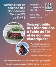
Séminaire Flood susceptibility mapping using AI and historic flood records

Offert par Heather McGrath, scientifique en données géospatiales, Ressources Naturelles Canada
Vendredi 21 février, 12h à 13h
Local 2422 ou Zoom
L'événement est gratuit et ouvert à tous et toutes, mais l'inscription est obligatoire en suivant ce lien.
Des viennoiseries et du café seront servis gratuitement.
Veuillez noter que la présentation aura lieu en anglais, avec la possibilité de poser vos questions dans les deux langues.
Abstract
In 2023, Natural Resources Canada (NRCan) released a national flood susceptibility (FS) map, developed using an ensemble of machine learning (ML) models trained on historical flood extents. This pioneering dataset addressed critical research questions, such as the impact of meteorological data on model performance, the suitability of a single national model versus region-specific models, and the identification of the most effective ML algorithms for this application. Since the release of FSv1.0, ongoing advancements have been made to refine the dataset, including enhanced data exploration techniques, improved feature selection methods, and the integration of deep learning models. These efforts aim to support the development of FSv2.0. This presentation will provide an overview of past and current FS research, highlighting key findings and methodological improvements. Additionally, we will explore other applications of artificial intelligence (AI) at NRCan, showcasing its potential to enhance flood mapping and risk assessments across Canada.
Biography
Heather McGrath is a geospatial scientist with Natural Resources Canada. Before joining NRCan, she worked in industry, working with GPS, land surveying, and collecting and processing of bathymetric data. She completed her PhD with Dr. Emmanuel Stefanakis at the University of New Brunswick, in collaboration with NRCan Geological Survey of Canada. McGraths’ current research interests include the utilization of AI in flood mapping and risk assessment.

